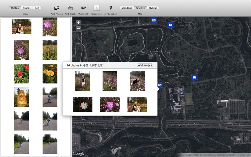
TourTracks is a powerful tracking pictures viewing application. We do the exact matching by taking advantage of the time of the tracks and the pictures, then we got the amazing mixed view.
Its very simple, just import the gpx files and pictures into the document.
Imported tracks will been show up on the map immediately.
Imported pictures containing location information will be displayed on the map at the corresponding position.
The program will match the pictures and the tracks automatically, then show the tracks and pictures on the map.
And the program will do reverse query by the tracks and pictures location information, and show these positions in the page of location.
Built-in fast, smooth picture browser, even the DSLR shooting high-resolution pictures can be opened immediately. Supports Mac trackpad gestures, you can easily zoom, move, rotate pictures.
The track file only can be gpx format currently.
Feature Highlights:
1. Import Gpx file and show on the map.
2. Matching the time of gpx track and imported pictures, then show on the map.
3. Adjust the time zone and offset of the tracks.
4. Geotag reversing. According to geotag, the pictures will be classified automatically.
5. Built-in quick and smooth image browser that support zoom, move, rotate gestures.
6. Supports jpeg, jpeg2000, tiff, bmp, gif, png, psd and other popular image formats.
7. Support cannon, nikon, Kodak camera raw format images.
8. Support for pictures with location information and display them on the map.
9. Clustering mode display pictures on the map.
10. track, point, geotag mode view pictures.
11. Use external program to open the picture.
12. Write the location information to the picture.
13. Show my position on the map.


